
Atacama Desert Sees Rare Snowfall Across Wide Areas
Back-to-back winter storms blanketed parts of Chile's Atacama Desert with snow in August 2026. The weather event, fueled by a large atmospheric trough and coastal moisture, caused significant disruption and flooding.

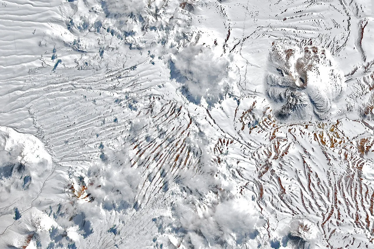
Northern Chile experienced a rare and widespread snowfall event in August 2026, as two winter storms covered significant portions of the typically arid Atacama Desert. While the region has seen snow before, notably in 2025, one of the August storms was particularly expansive, with precipitation reaching from the Andes mountains to near the Pacific coast. NASA's Landsat 8 and Landsat 9 satellites captured images showing snow blanketing the Chajnantor plateau, home to the advanced Atacama Large Millimeter/submillimeter Array (ALMA) radio telescope. The facility suspended operations during the inclement weather, moving its sensitive antennas into a protective state.
A subsequent storm later in August extended the snow cover even further west. Imagery from NASA's Terra satellite revealed snow stretching across the desert's hyper-arid core and reaching close to the coast south of Antofagasta. This coastal area, also home to several major astronomical observatories, saw operations temporarily halted. The unusual precipitation events were attributed to cutoff low-pressure systems. René Garreaud, an atmospheric scientist at the University of Chile, explained that the late-August storm originated from a particularly large trough that influenced weather patterns across a vast swathe of the hemisphere.
Storm Dynamics and Widespread Impact
The confluence of this widespread atmospheric disruption and ample moisture from the coast led to precipitation falling in an unusually broad area. This included offshore regions, the coastline, the desert interior, and the Andes. Garreaud described the magnitude of snowfall as "rarely seen in the otherwise extremely arid region," noting that some areas received rain instead of snow. The coastal city of Taltal, for example, recorded nearly 40 millimeters (1.6 inches) of rain in three days, a figure approximately ten times its annual average. Garreaud added, "We see these kinds of events only a few times, if any, per decade."
Beyond the snow, the abundant precipitation triggered destructive mudflows and flash flooding across northern Chile. The National Disaster Prevention and Response Service (SENAPRED) reported that thousands of people were affected and hundreds of homes sustained significant damage. This wet winter in northern Chile is occurring against the backdrop of a strengthening El Niño. Scientists note that during El Niño phases, the subtropical Pacific high pressure system, which typically keeps the region dry, tends to weaken. Simultaneously, a blocking high pressure system often forms near the southern tip of the continent. These combined atmospheric shifts can push the storm track further north, bringing more moisture and precipitation to areas like the Atacama Desert.
The severe weather in August followed another significant precipitation event in July that impacted Chile's Norte Chico region. The cumulative effect of these unusual weather patterns highlights the dynamic and sometimes unpredictable nature of climate systems, particularly during pronounced El Niño periods. The astronomical observatories and research facilities in the region, vital for understanding the universe, demonstrated their vulnerability to extreme weather events, necessitating protective measures during these rare occurrences.