El Nino 2026 Intensity Forecast Shows Stronger Ocean Pattern
New oceanographic data from 2026 indicates a stronger-than-expected El Niño pattern developing across the Pacific. Scientists warn of intensified weather disruptions and climate impacts.
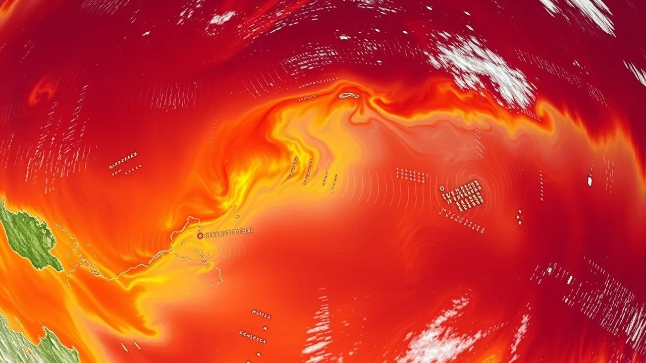
The National Oceanic and Atmospheric Administration released updated forecasting models on May 12, 2026, confirming that El Niño conditions will intensify significantly through the second half of 2026. Ocean temperatures in the eastern equatorial Pacific have already climbed 0.8 degrees Celsius above the 30-year baseline, marking one of the steepest early-season warming trends on record.
"We are tracking conditions that closely resemble the 1997-1998 super El Niño event," said Dr. Michael Chen, lead oceanographer at the Pacific Climate Monitoring Center, in a statement released Tuesday. "The combination of weakening trade winds and accelerating warm-water discharge from the western Pacific creates a compounding effect we have not observed since the early 2000s."
El Niño patterns emerge when trade winds weaken and warm water pools shift eastward across the Pacific Ocean. These shifts alter jet stream positioning, redistribute atmospheric moisture, and trigger ripple effects across global weather systems. The 2026 pattern is expected to peak between September and November, potentially creating one of the strongest el nino 2026 events in three decades.
Global Weather Disruptions Already Underway
Early indicators of the strengthening pattern have emerged across multiple continents. The southwestern United States is experiencing elevated drought risk for summer 2026, with precipitation models showing a 60-70 percent likelihood of below-normal rainfall across Arizona, Nevada, and southern California through August.
Meanwhile, Southeast Asia is preparing for intense monsoon rains. The Philippine Atmospheric Geophysical and Astronomical Services Administration has issued alerts for flooding and landslide risk in northern Luzon from June onward. Indonesia, which experienced severe drought during the 2015-2016 El Niño, is mobilizing water resources and implementing rationing protocols in vulnerable provinces.
Tropical cyclone activity shows mixed signals. The Atlantic basin is expected to remain relatively quiet, with fewer hurricanes than normal, while the western Pacific typhoon season may see heightened intensity in August and September. Australia's rainfall patterns will shift, with eastern coastal regions receiving above-normal moisture while interior agricultural zones face drying.
Why Climate Change Is Amplifying 2026 Impacts
Scientists emphasize that today's El Niño occurs within a fundamentally warmer global baseline. Since the 1990s, baseline ocean temperatures have risen approximately 0.13 degrees Celsius per decade. This warming serves as a multiplier for El Niño intensity.
"The ocean is starting from a warmer state," explained Dr. Sarah Martinez of the Intergovernmental Panel on Climate Change's working group on weather patterns. "An El Niño superimposed on already-elevated temperatures creates more energy in the system. We see stronger temperature extremes, more moisture in some regions, severe drying in others."
The interaction between El Niño and climate impact projections creates compounding concerns for agriculture, water supply, and energy infrastructure. Crop yields in East Africa face downside risk due to erratic rainfall. Coffee and cocoa-producing regions in Central America are assessing irrigation capacity. Energy demand for cooling and water pumping will likely exceed 2025 peaks.
Insurance and reinsurance markets have already begun adjusting premiums for drought-prone and flood-prone regions in 2026. Property and casualty insurers are modeling 15-25 percent higher loss potential for the second and third quarters, reflecting uncertainty around peak El Niño timing.
Oceanographic Monitoring and Forecast Confidence
Multiple international centers track El Niño using buoy networks, satellite observations, and numerical oceanographic models. The Tropical Atmosphere Ocean array, maintained jointly by NOAA and the Scripps Institution of Oceanography, operates 70 moored buoys across the equatorial Pacific, collecting real-time temperature and current data.
Forecast models show broad consensus that El Niño will persist through early 2027. The probability of strong-to-very-strong conditions by September 2026 stands at 72 percent across the ensemble of major climate centers, including the European Centre for Medium-Range Weather Forecasts and the Japan Meteorological Agency.
Key metrics tracked include the Oceanic Nino Index, which measures sea-surface temperature anomalies across the central equatorial Pacific, and the Southern Oscillation Index, which reflects large-scale pressure differences across the tropical Pacific. Both indices have crossed thresholds typical of strong El Niño episodes.
Longer-term implications for the Arctic remain uncertain. Some models suggest a strengthening polar vortex and cooler winters in eastern North America during 2026-2027, while others point to continued Arctic warming and sea-ice retreat. The full cascade of atmospheric science interactions will not be fully apparent until autumn.
Water resource managers, agriculture departments, and disaster-response agencies across the Pacific Rim are updating contingency plans based on the latest forecasts. The World Meteorological Organization has issued guidance to member nations to revise seasonal outlooks and prepare public communication strategies. For farmers, utilities, and infrastructure planners, the next six months will require vigilant monitoring and flexible adaptation protocols.